History
Astorians
The first land route across what is now the United States that was well-mapped was that taken by Lewis and Clark from 1804 to 1805. They believed they had found a practical route to the west coast. However, the pass through the Rocky Mountains they took, Lolo Pass, turned out to be too difficult for wagons to pass. In 1810, John Jacob Astor outfitted an expedition (known popularly as the Astor Expedition or Astorians) to find an overland supply route for establishing a fur trading post at the mouth of the Columbia River at Fort Astoria. Most of Astor's partners and all of his staff were former employees of the Northwest Company, known as Nor'Westers.
Fearing attack by Blackfeet, the expedition veered south of the Lewis and Clark route in what is now South Dakota and in the process passed through what is now Wyoming and then down the Snake River to the Columbia River.
Members of the party, including Robert Stuart, one of the Nor'wester partners, returned back east after the American Fur Company staff there sold the fort to British Northwest Company staff, who took over the outpost in the War of 1812 via the Snake River. The party stumbled upon South Pass: a wide, low pass through the Rockies in Wyoming. The party continued via the Platte River. This turned out to be a practical wagon route, and Stuart's journals were a meticulous account of it.
Fort Astoria was returned to United States control at the end of the war. However, the British Hudson's Bay Company came to control the fur trade in the region, especially after its merger with the North West Company in 1821.
Great American Desert
Westward expansion did not begin immediately, however. Reports from expeditions in 1806 by Lieutenant Zebulon Pike and in 1819 by Major Stephen Long described the Great Plains as "unfit for human habitation" and "The Great American Desert". These descriptions were mainly based on the relative lack of timber and surface water. The images of sandy wastelands conjured up by terms like "desert" were tempered by the many reports of vast herds of bison. It was not until later that the Ogallala Aquifer would be discovered and used for irrigation, and railroads would allow farm products to be transported to distant markets and lumber imported. In the meantime, the Great Plains remained unattractive for general settlement, especially when compared to the fertile lands, big rivers, and seaports of Oregon.
The route of the Oregon Trail began to be scouted out as early as 1823 by fur traders and explorers. The trail began to be regularly used by fur traders, missionaries, and military expeditions during the 1830s. At the same time, small groups of individuals and the occasional family attempted to follow the trail, and some succeeded in arriving at Fort Vancouver in Washington.
Elm Grove Expedition
On May 16, 1842 the first organized wagon train on the Oregon Trail set out from Elm Grove, Missouri, with more than 100 pioneers (members of the party later disagreed over the size of the party, one stating 160 adults and children were in the party, while another counted only 105). The party was led by Elijah White, appointed Indian Sub-Agent to Oregon, the first U.S. official in the region (never confirmed by Congress). Despite company policy to discourage U.S. emigration, John McLoughlin, Factor of the Hudson's Bay Company at Fort Vancouver, offered the American settlers food and farming equipment on credit, being unwilling to watch able-bodied people starve.
Free land
The biggest driving force for settlement was the offer of free land. In 1843 the settlers of the Willamette Valley by a vote of 52 to 50 drafted a constitution that organized the land claim process in the state. Married couples were allowed to claim up to 640 acres (a "section" which is a square mile, or 260 hectares) at no cost and singles could claim 320 acres.
In 1848, the United States formally declared what was left of the Oregon Country a U.S. territory, after it effectively partitioned it in 1846. The Donation Land Act of 1850 superseded the earlier laws, but it did recognize the earlier claims. Settlers after 1850 could be granted half a section (320 acres) if married and a quarter section if single. A four-year residence and cultivation was required. In 1854 the land was no longer free (although still cheap—initially $1.25/acre, or $0.51/ha).
Opening of the trail
In what was dubbed "The Great Migration of 1843" or the "Wagon Train of 1843", an estimated 800 immigrants, led by Marcus Whitman, arrived in the Willamette Valley. Hundreds of thousands more followed, especially after gold was discovered in California in 1848. The trail was still in use during the Civil War, but traffic declined after 1869 when the transcontinental railroad was completed. The trail continued to be used into the 1890s, and modern highways eventually paralleled large portions of the trail.
Other migration paths for early settlers prior to the establishment of the transcontinental railroads involved taking passage on a ship rounding the Cape Horn of South America or to the Isthmus (now Panama) between North and South America. There, an arduous mule trek through hazardous swamps and rain forests awaited the traveler. A ship was typically then taken to San Francisco, California.
Routes
The trail is marked by numerous cutoffs and shortcuts from Missouri to Oregon. The basic route follows river valleys. Starting initially in Independence/Kansas City, the trail followed the Santa Fe Trail south of the Wakarusa River. After crossing The Hill at Lawrence, Kansas, it crossed the Kansas River near Topeka, Kansas, and angled to Nebraska paralleling the Little Blue River until reaching the south side of the Platte River. It followed the Platte, North Platte, and Sweetwater Rivers to South Pass in the Rocky Mountains in Wyoming. From South Pass the trail parallels the Snake River to the Columbia River before arriving at Oregon City or taking the Barlow Road to the Willamette Valley and other destinations in what are now the states of Washington and Oregon.
U.S. Highway 26 follows the Oregon Trail for much of its length.
While the first few parties organized and departed from Elm Grove, the Oregon Trail's generally designated starting point was Independence or Westport on the Missouri River. Several towns along the Missouri River had feeder trails and make claims to being the starting point including Weston, Missouri, Fort Leavenworth, Kansas, Atchison, Kansas, and St. Joseph, Missouri.
The Oregon Trail's designated termination point was Oregon City, at the time the proposed capital of the Oregon Territory. However, many settlers branched off or stopped short of this goal and settled at convenient or promising locations along the trail. Commerce with pioneers going further west greatly assisted these early settlements in getting established and launched local micro-economies critical to these settlements' prosperity.
At many places along the trail, alternate routes called "cutoffs" were established either to shorten the trail or to get around difficult terrain. The Lander and Sublette cutoffs provided shorter routes through the mountains than the main route, bypassing Fort Bridger. In later years, the Salt Lake cutoff provided a route to Salt Lake City.
Numerous other trails followed the Oregon Trail for part of its length. These include the Mormon Trail from Illinois to Utah, and the California Trail to the gold fields of California.
Remnants of the trail in Idaho, Kansas, Oregon, and Wyoming, have been listed on the National Register of Historic Places.
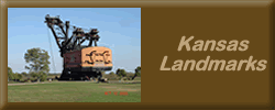
Landmarks
Many rock formations became famous landmarks that the Oregon Trail pioneers used to navigate as well as leave messages for pioneers following behind them. The first landmarks that the pioneers encountered were in western Nebraska, such as Courthouse and Jail Rocks, Chimney Rock, and Scotts Bluff. In Wyoming, names of pioneers can be seen carved into a landmark bluff called Register Cliff, and in Independence Rock. One Wyoming landmark along the trail, Ayres Natural Bridge, is now a state park of the same name.
Travel equipment
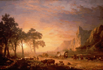
The Oregon Trail was too long and arduous for the standard Conestoga wagons used in the Eastern United States at that time for most freight transport. These big wagons had a reputation for killing their oxen teams approximately two thirds along the trail and leaving their unfortunate owners stranded in desolate, isolated territory. The only solution was to abandon all belongings and traipse onward with the supplies and tools that could be carried or dragged. In one case in 1846 on the California Trail, the Donner Party, en route to California, was stranded in the Sierra Nevada in November and three members are suggested to have resorted to cannibalism to survive.
This led to the rapid development of the prairie schooners. The wagon was approximately half the size of the big Conestogas but was also manufactured in quantity. It was designed for the Oregon Trail's conditions and was a marvel of engineering in its time. The covers of the wagons were treated with linseed oil to keep out the rain. However, the covers often eventually leaked anyway.
The recommended amount of food to take for an adult was 150 pounds (70 kg) of flour, 20 pounds (9 kg) of corn meal, 50 pounds (25 kg) of bacon, 40 pounds (20 kg) of sugar, 10 pounds (5 kg) of coffee, 15 pounds (7 kg) of dried fruit, 5 pounds (2 kg) of salt, half a pound (0.25 kg) of saleratus (baking soda), 2 pounds (1 kg) of tea, 5 pounds (2 kg) of rice, and 15 pounds (7 kg) of beans.
One of the important pieces of equipment for the pioneer were the guns they carried. Rifles, shotguns, and pistols provided protection for the travelers and a way to hunt fresh game to help maintain their physical strength and morale. Many formerly settled travelers, however, were unfamiliar with the safe use of such arms, and gun-related accidents were common on the pioneer trail. The common idea that such weapons were necessary protection from "hostile Natives" arose largely from an inflated view of the threat from tribal peoples to those on the trail; actual interactions were almost always peaceful and resulted in trade helpful to both travelers and natives.
Statistics
Immigration to Oregon Territory increased vastly between 1840 and 1852, the year of greatest migration. According to Oregon Trail Statistics by William E. Hill, the figures rocketed from 13 in 1840 to 1,475 four years later, nearly doubled the following year, and hit 4,000 in 1847. Emigration declined considerably prior to 1850, when 6,000 people trekked to Oregon. In 1851 the number dropped again (3,600) but sustained a huge comeback with 10,000 in 1852. (That same year some 60,000 people emigrated to Utah and California, a stand-alone record.) Another 13,500 people moved to Oregon in 1853-54, with 5,000 more making the trip as of 1859, the year of statehood. In the 20 years from 1840-1859 some 52,000 emigrants moved to Oregon, but nearly five times that number opted for California or Utah.
Though the numbers appear significant—and they were, especially in context of the times—vastly more people chose to remain at home in the 31 states. Part of the explanation is attributed to scout Kit Carson who reputedly said, "The cowards never started and the weak died on the way." According to some sources, one tenth of the emigrants perished on the way west.
Legacy
The western expansion and the Oregon Trail in particular inspired many songs that told of the settlers' experiences. "Uncle Sam's Farm," encouraged east-coast dwellers to "Come right away. Our lands they are broad enough, so don't be alarmed. Uncle Sam is rich enough to give us all a farm." In "Western Country," the singer exhorts that "if I had no horse at all, I'd still be a hauling, far across those Rocky Mountains, goin' away to Oregon."
When purchasing a new vehicle from 1995-1998, Oregonians could purchase special commemorative Oregon Trail license plates for their cars for an added fee.
An Early Kansas History of the Oregon Trail
by Frank W. Blackmar (1912)
The Oregon Trail, which started from Independence, Mo., entered Kansas near the mouth of the Kansas river and ran in a general westerly direction to the Pacific coast, the approximate distance being about 2,124 miles. The early history of the trail dates back to the time of the Astorian expeditions of 1811-1813. In 1823 or 1824 Gen. W. H. Ashley traversed the trail, discovering a more suitable way through the Rocky mountains by way of South Pass. Jedidiah S. Smith in 1826; Capt. Benjamin L. E. Bonneville and party in 1832, and Nathaniel J. Wyatt the same year, were among the first to leave written accounts of having traveled over this historic thoroughfare. The trail was undoubtedly a well-established Indian highway long before its use by the trappers, hunters and early explorers.
As early as 1840 it came into general use, and during the next seven years approximately 12,000 persons destined for Oregon passed over it. From 1840 until the advent of the railroad, it was practically the only way to reach those remote localities unless going by water. During the Mormon hegira and the subsequent emigration to California, thousands of emigrants left the Missouri river for the far west, though no correct figures are obtainable of the extent of the passenger and freight traffic passing over the trail. That part of the trail between Independence and Grand Island on the Platte river was in use at an early day, but no record of when or by whom it was opened can be found.
Fort Leavenworth, St. Joseph, Mo., and Council Bluffs, Iowa, figured some as outfitting points for emigrants during the latter days of the trail, and the road from the first two points intersected the Independence road in what is now Marshall county, Kan., but the bulk of freight and travel went by way of Independence, from which point the trail entered Kansas in Sec. 22, T. 12, R. 25 E., and traversed the counties of Johnson, Douglas, Shawnee, Pottawatomie, Marshall and Washington, leaving the state in Sec. 6, T. 1, R. 5, near the 97th meridian.
In its early days the following were the noted points along the line, in what is now Kansas, and their distances from Independence: Elm Grove, Round Grove, or Caravan Grove, variously called, 33 miles; Junction of Oregon and Santa Fe trails, 41; Wakarusa creek, 53; Kansas river, 81; Turkey creek, 95; Little Vermillion, 119; Big Vermillion, 160; Big Blue, 174; Nebraska line, about 200 miles.
The route in detail through Kansas, as taken from the original surveys now on file in the office of state auditor at Topeka, was about as follows: Entering Kansas in Johnson county it passed along the Santa Fe trail through what is Olathe, and on to the junction of the Oregon and Santa Fe trails located a little south of west of the present town of Gardner; thence continuing in a northerly direction towards the Kansas river, it entered Douglas county in Sec. 27, T. 13, R. 21 E.; thence to the west a little south of the present town of Eudora; thence in a northwesterly direction through the old town of Franklin to the site of the present city of Lawrence; thence via Marshall and Big Springs, entering Shawnee county in Sec. 15, T. 12, R. 17 E.; thence up the south side of the Kansas river, passing the village of Tecumseh, to the Kansas river at Papan's ferry, now in the heart of Topeka, where it crossed to the north side of the river, continuing west about midway between Soldier creek and the river, near the modern villages of Menoken, Silver Lake and Kingville and on to Rossville, crossing old Turkey (now Cross) creek and entering Pottawatomie county in Section 14, T. 10, R. 12 E.; thence up the Kaw valley past St. Mary's, turning to the northwest at a point about two miles east of Louisville and continuing in a line slightly to the east of the town of Westmoreland; thence in a northwest direction and entering Marshall county in Sec. 32, T. 5, R. 9 E.; thence northwest towards the Black Vermillion, the road forking about 2 miles south of that stream, which was crossed by both branches of the trail at a point about midway between the modern villages of Bigelow and Barrett; thence, the old trail, known as the South California road, crossed the Big Blue near the mouth of the Little Blue, while the northern branch ran northwest to the Frank Marshall crossing at Marysville, near which place the roads from Fort Leavenworth and St. Joseph intersected the Independence road, and the two forks of the latter entered Washington county in Secs. 13 and 24, T. 2, R. 5 E., the two trails joining in Sec. 13 and thence running north to the Nebraska line.
Ezra Meeker, an Oregon pioneer, in 1909 and 1910, made two trips from that state over the trail with an ox team, and by public talks and lectures has succeeded in having many historic points along the highway marked. He now has a bill before Congress in an effort to secure national aid in the permanent marking of the trail.