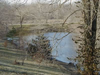
Course of the Marmation
The Marmaton River rises in Kansas northeast of Moran in eastern Allen County and flows generally eastward through Bourbon County in Kansas and Vernon County in Missouri, past the towns of Uniontown, Redfield and Fort Scott in Kansas and Deerfield in Missouri. It joins the Little Osage River from the south, 7 mi (11.3 km) south-southeast of Rich Hill, Missouri.
History of the Marmation River Ferries
by George A Root
The Marmaton river rises in the eastern part of Marmaton township, Allen county, and flows south and east for about ten miles into the Marion township, Bourbon county. Thence, by a most circuitous route east and west across Bourbon county, it crosses the Kansas line and enters Missouri in Vernon county, to join the Little Osage river a few miles from Schell City. The stream is approximately 85 miles long, about 10 being in Allen county, 50 in Bourbon county, and 25 in the state of Missouri.
The late Judge Charles E. Cory, of Fort Scott, in his pamphlet Place Names Of Bourbon County, Kansas, has the following regarding the Marmaton:
The Marmaton had its name from the old French voyageurs or trappers who came here long before the settlers or even the traders came across the plains. Along this stream they first found prairie dogs, which they called Marmots, supposing them to be the little animal common in Europe, to which the prairie dog is related. The name Marmaton which they gave the stream, was a puzzling thing for the English-speaking hunters and the few settlers who soon came. They could not pronounce the nasal French "N." And so, for a long time, the writing and speaking of the name was badly confused. In old documents it is found written and printed Marmiton, Marmoton, Marmaton, Marmitaw, Marmotaw, and perhaps in other ways There are plenty of people now living who have heard it pronounced as if spelled in the last form. The speakers were trying to accommodate their English tongues to the French pronunciation. However, the name finally settled down to its present spelling.
Scant mention has been accorded this stream in histories of either Kansas or Missouri. Lippincott's Gazetteer has the most pretentious account we have examined -- about three or four lines -- reciting that it is a small river which rises in Allen county, runs across Bourbon county, and enters Missouri in Vernon county, and joins the little Osage about twelve miles north of Nevada.
The earliest mention of the Marmaton we have located is on a map of a road from Fort Coffey to Fort Leavenworth, prepared in 1837 by Charles Dimmock. He spelled the name Marmiton. Ferries were probably not needed on this river, except during the period of spring freshets. While there may have been one or more ferries operating earlier, the first mention we have noticed, is the following item printed in a newspaper of 1859:
Capt. Daniel Funk intends placing a large ferry boat at the lower ford of the Marmiton for the transportation of wagons and horses, during the high waters which prevail in the spring and fall. Such an institution is very much needed, and we trust the Capt. may be as successful in this line as he has been in his piscatorial operations. -- Fort Scott Democrat, August, 1859, reprinted in Lawrence Republican, August 11, 1859.
By 1860 the Fort Scott Bridge and Ferry Co. had been organized, and at the special session of the legislature that year obtained authority to erect a toll bridge across the Marmaton river and Mill creek, at or near the mouth of Mill creek, in Bourbon county, and to keep a ferry on the Marmaton at that point until the bridge was built. This company included William R. Griffith, [1] William R. Judson, [2] H.T. Wilson, [3] S.A. Williams, B.F. Riggins and their associates. Their capital stock was divided into shares of $10 each, not to exceed $8,000 in all. This act was signed by Gov. Samuel Medary on February 25, 1860, [4] and took effect at once.
Probably the last movement for water transportation on this stream in Kansas was made by the Marmaton River Navigation Company, organized on July 1, 1890, at Fort Scott, for the purpose of making this stream within the state of Kansas navigable by slack water navigation for boats in the carriage of freight and passengers. The business of the corporation was to be transacted on and along the river, with the principal place of business in the city of Fort Scott. The corporation was "to exist for all time to come," and to be governed by a board of five directors, those chosen for the first year including F.L. Spengler, Emil Spengler, J.M. Limbocker, J.A. Schmith and Griffith Peters. The new corporation was capitalized at $5,000, divided into 200 shares of $25 each. This charter was filed with the secretary of state July 9, 1890. [5]
The Marmaton has numerous tributaries, the main ones from the north being Turkey and Mill creeks, and from the south Yellow Paint creek, made famous by Eugene F. Ware, the "Paint creek bard." At times excessive rains in the watershed drained by the Marmaton have disrupted travel and made ferrying necessary. One such freshet occurred during the spring of 1862, when the military bridge across the Marmaton was swept away. Another flood occurred on July 11, 1869, when many houses in the Marmaton bottom were completely submerged. [6]
No mention has been found of the date the first bridge was built across the Marmaton, but it must have been in the early 1860s, for an item in the State Journal, of Lawrence, of May 1, 1862, mentioned that the military bridge across this river had been swept away. This structure was probably close to the old ford where the military road from Fort Leavenworth to Fort Gibson crossed the river, about a mile east of town. This bridge, or one that replaced it, was known as the "Osbun" bridge, because it was on the farm of Dr. A.G. Osbun, one of the earliest settlers in the county. [7] In 1933 a new structure over the river at this point was dedicated. An Associated Press dispatch of March 22, said:
A concrete bridge costing $40,000, built across the Marmaton river by the city [Fort Scott], was dedicated here today. Opening of the bridge on National avenue marks the end of detours on U.S. highway 73 E and 54 through here. The dedication program included a parade, an address by Mayor Martin Miller, vaudeville entertainment at Memorial Hall and a salute by Battery E, 161st field artillery. The bridge replaces a steel structure built in 1872, one section of which collapsed in July, 1931, killing a workman repairing a girder. The new bridge is 200 feet long and of rainbow arch type.
The city of Fort Scott, built around the old fort which was established in 1842, was on the old military road running south. For many years this was the only established highway reaching the frontier forts and Indian settlements to the south. In later years a number of roads were laid out to and from Fort Scott. One in 1859 ran to Leavenworth; one in 1865 to Ottawa; another the same year, to Iola; one in 1868 to Baxter Springs, and one in 1870 to Erie, These roads were primary factors in the development of the south-eastern portion of the state, which, up to the early 1870s had been the habitat of various Indian tribes.
Kansas State Historical Society.
NOTE: The numbers in brackets are links to footnotes for this text.
NOTES
1. William R. Griffith was the first State Superintendent of Public Instruction.
2. William R. Judson was colonel of the Sixth Kansas cavalry.
3. Hiero T. Wilson was a prominent early day citizen of Fort Scott. He was appointed postmaster February 26, 1849, and in 1854 was appointed county commissioner. He was a judge of the first election, November 19, 1854, and an early director of the Kansas State Historical Society.
4. House Journal, 1860, special session, pp. 299, 334, 537. Senate Journal, 1860, special session, pp. 495, 519. Laws, 1860, special session. pp. 16, 17.
5. "Corporations," v. 35, p. 380.
6. State Journal, Lawrence, May 1, 1862. Fort Scott Monitor, July 14, 1869.
7. Cory, Place Names of Bourbon County, Kansas, p. 34.
8. Laws, Kansas, 1859, p. 585; 1865, p. 145; 1867, pp. 247, 261; 1870, p. 210. Original plats of above roads are in the Archives division of the Kansas State Historical Society.
|